Showing posts with label 14er. Show all posts

Sunday, September 27, 2009

Sherman Engagement


On Sunday, Melissa and I attempt to climb Mt. Sherman 14,036' in the Mosquito Range from the Iowa Gulch trail head in Leadville. We started at 6:15 a.m. and got to the ridge line where we were turned back by wind that was knocking us off our feet. This would have been my second summit of Sherman and Melissa's first.

My plans for the top fell through, but I found a great opportunity on the way down. After getting out of the wind, I set a ring on top of a cairn (trail marker above treeline) on the side of the trail. As Melissa approached, she asked if I was going to take a picture of the unique cairn. Then she saw the ring. I got down on one knee and asked her to marry me. She said YES!

We are looking at about a year till the wedding. Time to start planning!


Click HERE to see a larger slideshow.

Friday, September 11, 2009

Mt. Massive - 14,421 ft.

Top of Mt. Massive 14,421'. Number 15!

On Friday, my friend and old roommate from Silverthorne, Gary Waterman and I summited Mt. Massive. On Thursday evening we drove from Gary's place in Frisco, over to Leadville and up the Halfmoon Road to the Halfmoon trail head. A 4x4 vehicle is needed to navigate the top portion of this dirt road. They have greatly improved the conditions of the road this summer, so even AWD vehicles like Subarus could make it. We camped in one of the many dispersed tent spots near the trail head.

Around 4:30 a.m. on Friday we woke, made some oatmeal and tea, packed up and were on the trail by 5:30 a.m. It was a beautiful morning, crisp fall-like temps with a bright moon and stars aglow. Out headlamps blazed the trail ahead of us until we reached a clearing area around 11,200 and the trail junction towards the top.

Trail junction to Mt. Massive summit. Gary on the trail ahead.

From here the climb gets steep, 35 degrees over the next two and a half miles to the ridge line, gaining about 3,200 ft in elevation. We steadily climbed towards the top and were met with debris from the Aug. 19 Black Hawk helicopter crash near the ridge line. After meeting up with the standard North facing route, we climbed across the "massive" ridge over four or five false summits and up to the real summit at 14,421' at 8:45 a.m. It was a clear day, but a little hazy with the lingering smoke from the California fires.

Debris from the Black Hawk helicopter crash near the summit.

The view looking Southwest from the top.


Panoramic view from the top. Click on image for larger view.

We enjoyed a snack and the view from the top for about 30 min and then began the long steep descent. While traversing across the Black Hawk crash site, we picked up debris that was along the trail to help with the clean up. There were tons of tiny scraps still lying around. Most likely the debris will be up there for years.

We made it back to the trail head at 11:45 pm, 6 hrs. and 15 min. round trip. An excellent hike, with great company, on a beautiful day!

NOTE: Stats and info about Mt. Massive are listed below the slide show.

Since Melissa was back East for a visit with friends, work and a wedding, she had my camera and I was trying to use hers, which is on it's last leg. So, I only got a few shots compared to the amount I usually take. I supplemented the images with some shots from the 14ers.com website, where we get all out hiking info (marked with 14ers.com).

Photos from the trip are in a slide show below. Enjoy!
(You can click the icon in the lower right for a larger view.)


Mt. Massive
General Information & History


Map of Mt. Massive trails. We took the Southwest Slope route #2, blue line on the left.

Mt. Massive was named by Henry Gannett in 1873 as part of the HaydenSurvey of the American West. First recorded ascent in 1863 by Henry Gannett.

Mt. Massive is the second highest peak in Colorado and the third highest in the 48 states, exceeded only by California's Mt. Whitney and its near neighbor, Mt. Elbert. It's name tells all. It has five summits above 14,000 feet on a 3-mile-long ridge. Massive has more area above 14,000 feet than any other mountain in the 48 states, narrowly edging Mt. Rainier in that category. The mountain, along with Mt. Elbert, forms much of the western skyline of Leadville, which is 11 miles east and slightly north.

Mount Massive is part of the Sawatch Range with Mount Elbert. This range of mountains was formed by uplifting along the continental divide, where two tectonic plates are being pushed together. There are several glacial lakes in the wilderness area. The lower slopes of the mountain are covered in lodgepole pine forests, which gradually yield to Engelmann Spruce and Subalpine Fir. Treeline is just below 12,000 feet.

The mountain and 30,540 acres of the surrounding area were designated the Mount Massive Wilderness by Congress in 1980.

SOURCE - Summitpost.org


Wednesday, September 2, 2009

DemCamLinBro

Melissa at the top of Mt. Lincoln (14,286')

This past Saturday, Melissa, Erich, Julia, Yeti and I headed into Alma and up Buckskin St. to the Kite Lake trail head. From here you can summit four 14ers in a round trip of just 7.25 miles with 3,700' in elevation gain. The 14ers include Mt. Democrat 14,148', Mt. Cameron 14,238', Mt. Lincoln 14,286' and Mt. Bross 14,172'. These four peaks, plus Mt. Sherman 14,036' (I have summited, but Melissa has not yet), make up the Mosquito Range in Park County, just South of Summit County.

Map of the route. We traveled clockwise from the blue arrow.

This hike is very popular due to its proximity to Denver, the combination hike opportunity and they are fairly short and easy Class 2 hikes when compared to most of the 14ers in Colorado. So you have to get here early. We stayed at the condo in Keystone on Friday night and woke up bright and early at 3:00 a.m. to hit the trail. We were geared up and on the trail by 6 a.m. as the sun started to rise. There were already many cars in the parking lot, so we could tell it would be a busy day. Many parts of the trail system passes through private property. There are a ton of mining claims around these peaks, so you have to stay on the trail.

We summited Democrat with about 20 others. Number 11 for me and 10 for Melissa. Democrat was the hardest out of the four with 2,150' of elevation gain over two miles. However, compared to our last 14er (Mt. of the Holy Cross , 6 miles, 4,500' gain to the top) this one was a cake walk. Erich, Julia and Yeti all summited with us. I think this is number six for Yeti!

Melissa and Jason at the op of Mt. Democrat 14,148'

Then it was on to Mt. Cameron. We down climbed back to the saddle and then headed up Cameron. Julia did not get much sleep with her night work schedule over the past week, so she was feeling a bit sick and decided to turn around with Erich and Yeti. Melissa and I continued on to the top and bagged number 11 for Melissa and 12 for me. Mt. Cameron has a large flat top strewn with loose rock. Not that exciting of a 14er, but we'll count it.

Next up, Mt. Lincoln. The view of Lincoln from Cameron was an interesting one. Besides the hundreds of people on the trails to and from, there was a vast "wastland" of a saddle between the two peaks. We made quick time of the short hike between the two and joined another large group for lunch at the top of Lincoln. Number 13 for me and 12 for Melissa.

View from the top of Mt. Cameron over to Mt. Lincoln.

At the top of each peak we took photos and checked out the scenery. On each peak we got a photo of us with our WhichWich bags. WhichWich is a local chain sub shop that offers free sandwiches to anyone who hands in a photo of themselves with the sandwich bag on the top. Sweet, four free sandwiches this week!

Melissa with her WhichWich bag. Free sandwich!

Now on to the final peak of the day, Bross. We headed back down Lincoln and towards Cameron, just below the peak we traversed left and along the gentle decline along the Cameron/Bross saddle. Talk about cake walk, it might as well have been a dirt road, and pretty much was, once we started to ascend Bross. Mining roads were all over the place and we followed one up to the summit at 14,172'. Number four on the day and 13 overall for Melissa and 14 for me.

Time to head down and get away form all these people. There must have been about a thousand people (no joke) strewn out across the four peaks. I've never seen a set of trails so busy! The descent from Bross is fairly steep and full of loose rotten rock. I'm sure glad I had my trekking poles or I would have ended up on my ass a few times. Many amateur hikers were all over the trail falling and slipping their way down. It was nice to finally be at the car and on our way away from the crowds.

Panoramic view from the trail head.
Left to Right: Mt. Democrat, Mt. Cameron, Mt. Bross.
Lincoln is behind Cameron.
(Click on image for a larger view.)

We drove back to Keystone dreaming of the hot tub that awaited our sore muscles. We made a pitstop at Downstiars at Eric's in Breckenridge for some baked wings and a pint (I highly recommend the baked wings!). Great day overall, plus four 14ers to add to the list!

Check out the slide show below for more photos from the trip:
(You can click the icon in the lower right for a larger view.)

Monday, June 29, 2009

Mt. of the Holy Cross


See photos from the trip HERE
See a video clip of the Holy Cross valley HERE
See a panoramic video clip from the summit HERE

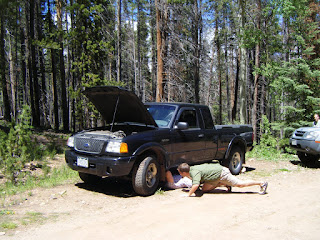
Well, it was quite the interesting weekend to say the least. On Saturday morning we headed out towards Vail to do some hiking, fishing and camping in the Holy Cross Wilderness. As I drove up Tigiwon Road, the eight mile access road to the campground I had a wee problem with my truck. White smoke stated to appear from the undercarriage and I lost all power on the gas. Upon stopping around a corner, I exited to find pretty much all the transmission fluid leaking out onto the road. Ends up I blew the transmission. The truck was towed to the nearest mechanic to sit for the weekend. Fortunately our friends Jaimee and Wes were on their way to join us, so we threw all our gear into their truck and continued on. We were a bit short on room in the Xtera, but it all worked out and we made it to the campground.


After setting up camp we hiked a bit up one of the nearby trails to Notch Creek and did some fly fishing near a beaver pond. The little brookies were biting and we caught a few before we headed back to camp for dinner.


Bright and early on Sunday, 4:00 a.m., Melissa and I woke to hit the trail and hike to the top of Mt. of the Holy Cross. As the sun rose, we arrived at the top of Half Moon pass, about 1,000 ft. vert from camp and at treeline. The trail then heads back down to the valley floor another 1,000 ft. We were not looking forward to tackling that on the way back. After traversing across the side of Notch Mtn. we got our first impressive look at Mt. of the Holy Cross. Quite a site and very imposing to see what the rest of the hike would look like along the north ridge. See a video clip of the Holy Cross valley HERE


After descending to the valley floor and crossing a raging creek, we again began to ascend back towards treeline and the corniced ridge to the summit. We hit some rough bouldered areas along with snow fields and the long cornice, but most of the trail was dry and clear of snow. The views surrounding us were amazing. The snow cornice provided relief from picking through the rocky ridge. After the snow ended we had a sharp ascent to the peak through a rock filled face.


Finally at the peak, mostly covered by snow, we rested and enjoyed the views for about 40 min. This was 14er number 10 for me (plus two double ascents) and nine for Melissa (out of 54 in Colorado). We shared the summit with four other humans and two canines. One of the girls at the top was only 11 and planned to hike all the 14ers by age 17. We wish her good luck and happy climbing! See a panoramic video clip from the summit HERE


After a snack and some hydration we headed down. It was going to be a long trip back. Sometimes you think the way down will be easier than the way up, but after hiking over five miles with 5,000 ft of vert, every step down takes as much effort as the steps up. We saw quite a few Marmots in the boulder field near treeline. As we got closer the the valley below, we remembered the 1,000 ft. of vert we were approaching that was between us and our campsite. The trail that switchbacks multiple times on the way back up to Half Moon pass ends up being one of the hardest parts of the route. We are used to heading all downhill back to the trail head. We pushed through it and returned to camp with another 14er in the bag, 11.5 miles of hiking with almost 6,000 ft of vert in about 9 hours (and one blown transmission).

What a great weekend, for the most part!

Which one will be next on the 14er checklist? Stay tuned to CO Adventure to see.


See photos from the trip HERE
See a video clip of the Holy Cross valley HERE
See a panoramic video clip from the summit HERE

Tuesday, June 2, 2009

Ascent of Mt Shavano


See photos from our trip HERE
See a video compilation from our hike HERE

It's the start of hiking season again! So, on Saturday we headed South West to the Sawatch Range near Salida and Buena Vista, CO to hike Mt. Shavano (a) (14,229'). It's about a 3.5 hour drive with some great scenery ranging from suburbs, to farms and mountain passes to free range high altitude plains. The weather was a bit suspect, with thunderclouds rolling in and out of the mountains. As we drove into the Buena Vista valley, we could see the Collegiate Peaks in the Northernmost point of the Sawatch range across the plains. The clouds surrounding the peak of Mt. Shavano (b) did not look very inviting, but we hoped for the best and continued the drive along a dirt road to the trailhead.


After gearing up in the parking lot, we headed out on to the Colorado Trail for a short distance and then onto the Mt. Savano trail for about an hour hike (3/4 mi.) up some steep terrain to a perfect camping spot. We enjoyed a camp meal of Mountain House mac and cheese and a game of Farkel by the camp fire and then headed to bed.


Sunday started early, 4:30 a.m.! It was still dark as we ate a hearty oatmeal breakfast and packed up camp. We left our large packs at camp and headed up the mountain with day packs as the sun rose. The trail provided numerous great views of the Southern Sawatch range and the blue skies were very promising, however the weather in Colorado can turn on a dime at elevation, so we kept an eye out for incoming storms. We hit tree line at about 11,700' and could then see most of our trail up to the saddle, still covered with snow. Fortunately the snow was firm so we did not have to worry about the agony of postholing on our way up. There were about seven others behind us on the trail, but due to our campsite in on the trail and early rising, we were pretty much alone till we hit the summit.


The last climb off the saddle was a tough one, with a steep grade and deeper snow. As we hit the top, one other gentleman joined us. And soon seven others. Usually you can see anywhere from 40 to 60 or more people on the trail of a 14er, but due to the early season timing, we were able to enjoy the mostly solitude trip.


It took us four hours to ascend about 3,600'. The views from the top were amazing. I've been up here before, about six years ago. Mt. Shavano was my first 14er. This was Melissa's first time up Mt. Shavano, so she now has eight under her belt, while I stayed at nine (11 total ascents with two doubles). There are 54 14ers in Colorado, so we still have a ways to go.

There is an option of traversing along the ridge and down to another ridge that leads up to Tabeguache Peak (pronounced "tab-uh-wash," with the accent on the first syllable) at 14,155'. We pondered over heading that way to bag another peak, but the clouds were starting to grow in size and were very dark. Our decision to head back down was a good once, since it started to get socked in and hail as we hit tree line again.

The descent was uneventful besides the bit of hail, and we were glad to arrive back at camp. However, we now had to load back up with all our overnight gear and hike out the last mile. We hit the car with a total round trip time of seven hours and fourty five minutes, not bad for our first 14er of the season.

Which one will be next. Evans, Sherman, Lincoln? Keep your eyes on COAdventure.blogspot.com to see where we head to next!

Map of trail

See photos and video from our trip HERE
See a video compilation from our hike HERE

Monday, August 25, 2008

Longs Peak


(Click on headline to see my photos from this post)

On Sunday, August 24, we climbed Longs Peak (14,255 ft). The hike was 15 miles round trip and took us 13.75 hours to complete. We started with five of us (Erich, Wes, Jaimee, Melissa and myself) but Jaimee and Wes had to turn back at the Keyhole due to some altitude sickness.

We camped at the Longs Peak campground on Saturday night. Melissa and I headed over to Lilly Lake on Saturday afternoon to fly fish. I caught a 16 inch Greenback Cutthroat Trout on my fourth cast. It was a beautiful fish.

Our climb started bright and early at 3 a.m. on Sunday. Due to hiking in the dark, I did not get many photos until the sun came up. We watched the sunrise at about mile four, just before the Boulder Field. The Boulder Field is a place where you can camp, prior to making your ascent on the peak, if you want to lug in a 40 pound pack the five miles. From the Boulder Field you can see the Keyhole, where the trail heads through and out to the North West side of the mountain. From this point, there is much more exposure and mostly third class climbing (you need to use your hands to negotiate the trail).

The Trough is one of the harder spots, because there is no noticeable trail and loose rock everywhere. At the top of the Trough you head over a crux and onto a narrow ledge for a while before the Homestretch. The Homestretch leads you up a smooth rock face to the top of Longs Peak.

Once over the top, the peak flattens out into a massive area about the size of two football fields at 14, 255 feet. The views were amazing and the weather was great. Sunny and barely and wind. We enjoyed the peak for a bit and had a quick lunch before heading back down.

The route back is the same as the way we came. However instead of pulling yourself up over all the rocks, you are lowering yourself down and sliding on your rear a bunch. As we came back through the keyhole, we saw the dark clouds heading our way. Erich stopped at one point halfway to the Boulder Field and put on his rain jacket. We joined him, and just in the nick of time. It started to rain and the clouds quickly blew in.

As we got to the campsites at the Boulder Filed, it started to hail and the lighting crashed down all around us. The thunder was so loud that it made you fall to your knees and shook your body. We found shelter with five others and sat out the hail storm for about 20 min. Check out the video of our experience here: Hail Storm Video.

The video only shows the very beginning of the storm. It got worse as the pea sized hail hit our backs and the lightning struck all around. By the time it passed there was about two inches of hail on the ground and covering all of us.

We then headed out to complete the rest of the five miles back to the trail head. Moving as fast as we could we still ran into a few more downpours and a little more hail. Our bodies and feet were aching as we willed our wet bodies down to the car. Our goal was to get to Oskar Blues Brewery and Restaurant as soon as possible to reward ourselves with a pint and burger. Boy did those taste good after that long day!!